Pages

Showing posts with label trekking blog. Show all posts

15.2.24

Mruggad Fort Trek


The Shape of the fort is like a peacock hence it would be name as Mrug (Peacock) gad (fort)

We the Trekking Paltan group visited the fort on July 3rd 2022
The fort is about 120 km from Pune. Bheliv is the name of the base village of the fort. The fort is seen from the Lion/Tiger Point Lonavla which is on the Amby valley road. 

Khandala -Khopoli - Imagica - Umbare -Durshet - Padghawali - left turn for Jabhulpada road - along the the river Amba - Mangaon bk - Bheliv 

Amba river
Parking at Bheliv village
Trekking start from this temple.
The total time required to get to the top of the forts is 40 to 50 mins.
The forts is small. There is a water tank, a goddess statue and a cave there on the top.
Try to move forward towards the end of the fort. 
after initial walk of 10 min, jungle patch starts 
Once you reach on open sky you will see a narrow pass
on the top of the pass, the main fort is on the left side and a cave is on the right side
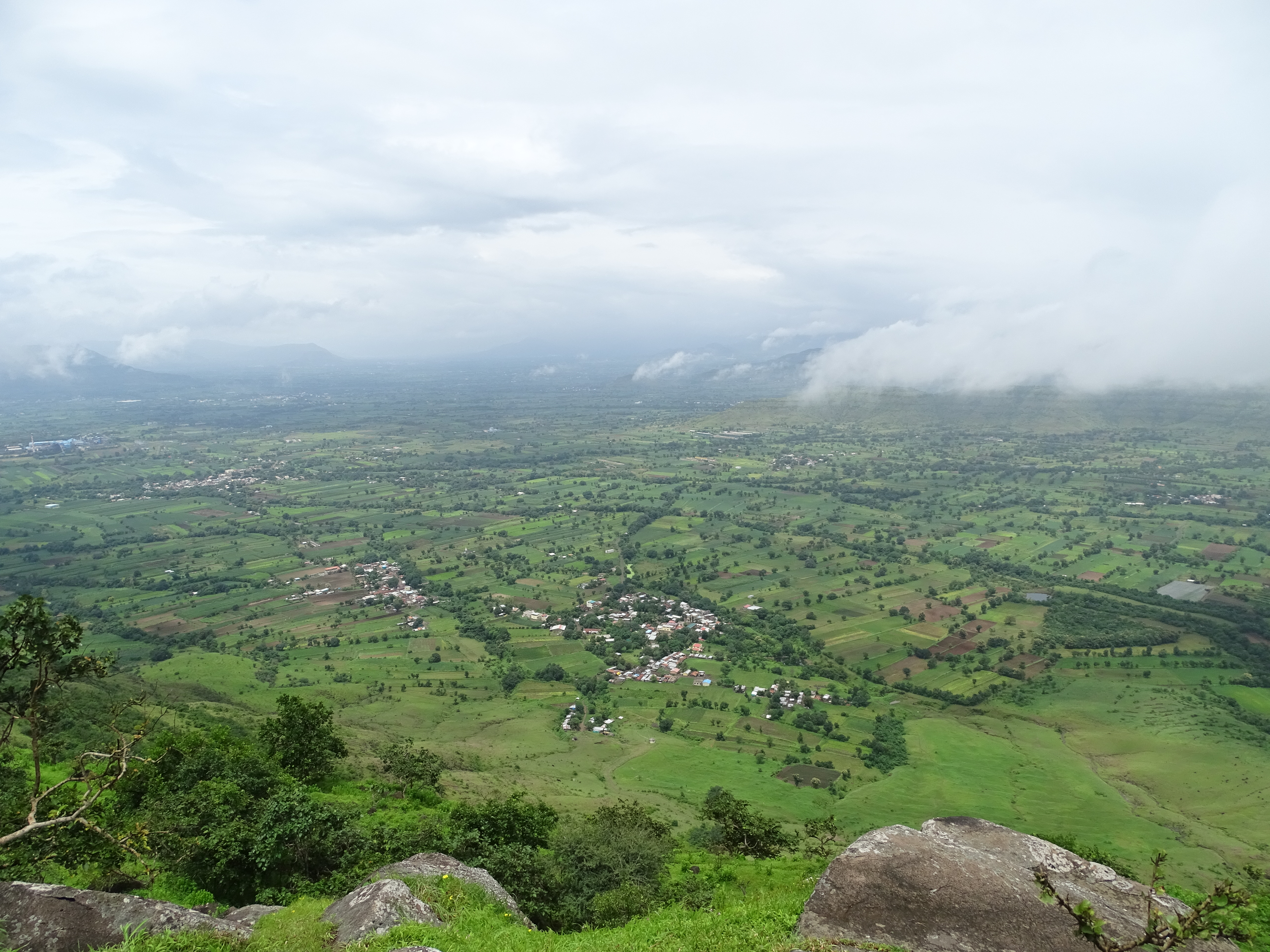
The Steps in the rock takes you to the top


The spectacular view of Lonavla and lion point


Goddess statue

Water tank


Rahul Jadhao, Sainath Jagdale, Shreerang Gorse, Pradeep Patil, Parshuram Bhangre, Anjali & Amol Gore, Sharad Potkule, Kumar Khunte
Seating- Dnyaneshwar Aarne and Akshay Kahde
Return journey


19.11.20

Vandangad Fort Trek Aug_2019


Vandangad is one of the famous fort near Satara city. It is usually named as its pairing fort Chandan i.e. Chandan-Vandan. There is lot confusion about the identity of the fort among local people, trekkers, websites even on Google map. 
How to identify Chandangad - There is a temple of Chandaneshwar and a banyan tree on Chandangad. 
How to identify Vandangad - There is Kalubai temple, Dhanyakothar and Masjid on the fort.

How to Reach From Pune :
It is about 95 km from Pune. Pune-Satara highway- Shirwal -Khambatki Ghat- Surur- Bhuinj- Leave the highway-Take left turn to Karkhana road- Kisanveer Sugar Factory-take left for Kikali Village-Kikali-Warachi Belmachi-Park vehicle.
The road is in good condition, even good for bus and cars. So approx. 2 hours will be required to reach the base village.  
trek route from 'Warachi Belmachi'
Parking - Find open place for the parking in the village warachi Belmachi. Ask local people then park only because there is no official parking.

Food and Water : Small shops are there in Warchi Belmachi to purchase water and snacks. Carry food and water with you because those are not available on the trek or fort.
About the Trek : The trek is easy. Its good for family, kids and senior citizens too. It takes almost 1 hour to reach at the main entrance 'Darwaja' and 90 mins. to reach on the fort i.e. 'Ballekilla'
This trek is not so popular so difficult to find clear trail to follow. Keep eyes on valley between two forts and waterfall path. 

Trek start point form the base village 'Warachi Belmachi'
In summer bikes can be reached up to the temple. 


Chandangad is on left side at the trail. After reaching on the top in the valley of both forts take right for Vandangad. After 60 mins trek from base you will be on the entrance of the fort. This is first phase you reach. 

This is Chandangad, take right turn ( U turn) from here.
Belmachi from the trek route

After 60 mins trek we reached at the Darwaja 

Banavadi village side in the  background
From the Darwaja we reach on the top of the fort in 15 minutes.


Mahadev Temple
After 20 mins trek you will reach to the Kalubai temple and Masjid. 

What to See : The fort is big, you need at least 90 minutes to explore the forts. Some residuals are found on the fort. Kalubai temple, Mahadev temple, Masjid, Darga, Dhanya kothar (grain storage) etc. are found.
You can see Chandangad, Vairatgad, Satar-Punehighway, Mahabaleshwar ridge, Kaas plateua ridge etc. from the top.

Trekkers - Sandip Jadhav,Sandeep Chaudhari, Pratham Patil(Jr.), Pradeep Patil, Kumar Khunte and Me ( behind camera)
Me