Mohangad Fort Trek


This fort also called Durgadi's Fort. It is named after the base village 'Durgadi'. Its a simple trek. Very beautiful in monsoon. Many Hindu visit the fort in 'Navratra' the Hindu festival of Goddess to make darshan of Goddess Durga Temple on the fort.
This fort is newly discovered so not known to many people. So go with group and hire a local guide from the village.
How to Reach - About 100 km. from Pune to base village Durgadi village. It will take 3 to 3.30 hours. The Ghat road is motorable but not in good condition. Very beautiful Journey in monsoon with lots of waterfalls. There are veg/non-veg restaurants on frequent distance.
Pune-Bhor-(State highway 70)Nigudghar-Varandha ghat-Hirdoshi-Take right turn to Shirgaon/Durgade village from main road - Durgadi is approx. 7 km. from main road.
This turn is crucial because no mark or board is there on the road. This turn is approx. 35 km from Bhor.
This turn takes you other side of backwater.
Journey from Bhor to Durgadi village is along with Neera Devghar Dam's backwater. There is small restaurant on the turn called Hotel Mohangad, but open sometimes. In case lost ask for Durgadi village.
Parking - Parking is free and unsupervised in Durgadi village.
Food n Stay - There are many restaurants available on Varandha Ghat. There is no restaurants in base village i.e. Durgadi, but homemade food can be made available on demand by villagers. Homely stay available at Durgadi village. Hotels for stay available to nearby cities like Bhor and Mahad.
About the Trek -
There are two trek routes from base village.
1. From Durga Mandir (easier) - 2:30/3 hrs. will require to reach on the top. Its a simple trek route. Better for car and bus parking. The mandir comes about 2 km after turning main road. There are few farm houses around. There are no houses around the mandir. Actual Durgadi village is further on distance of 5 km. If you dont have food, then first go to village , make arrangements then come back and start trek. This is simple trek, no more risky spots. You can see fort in front of you, follow it.
2. From Jani Andhari Baji Mandir-Durgadi village - Its little difficult than first one. Need 2 hours to reach on the top. Take guide of you going from this route. Recoomanded only for experienced trekkers. First reach to Durgadi village, ask them about Jani Andhari Baji Temple or parking. Its a right hand turn from the village. It is very rough road with stones. Cars not recommended on this road. Also difficult for Buses. The temple is about 2 km from settlement in remote and lonely place.
Guide is must from this route.
Route 2: Take care where cross is made.
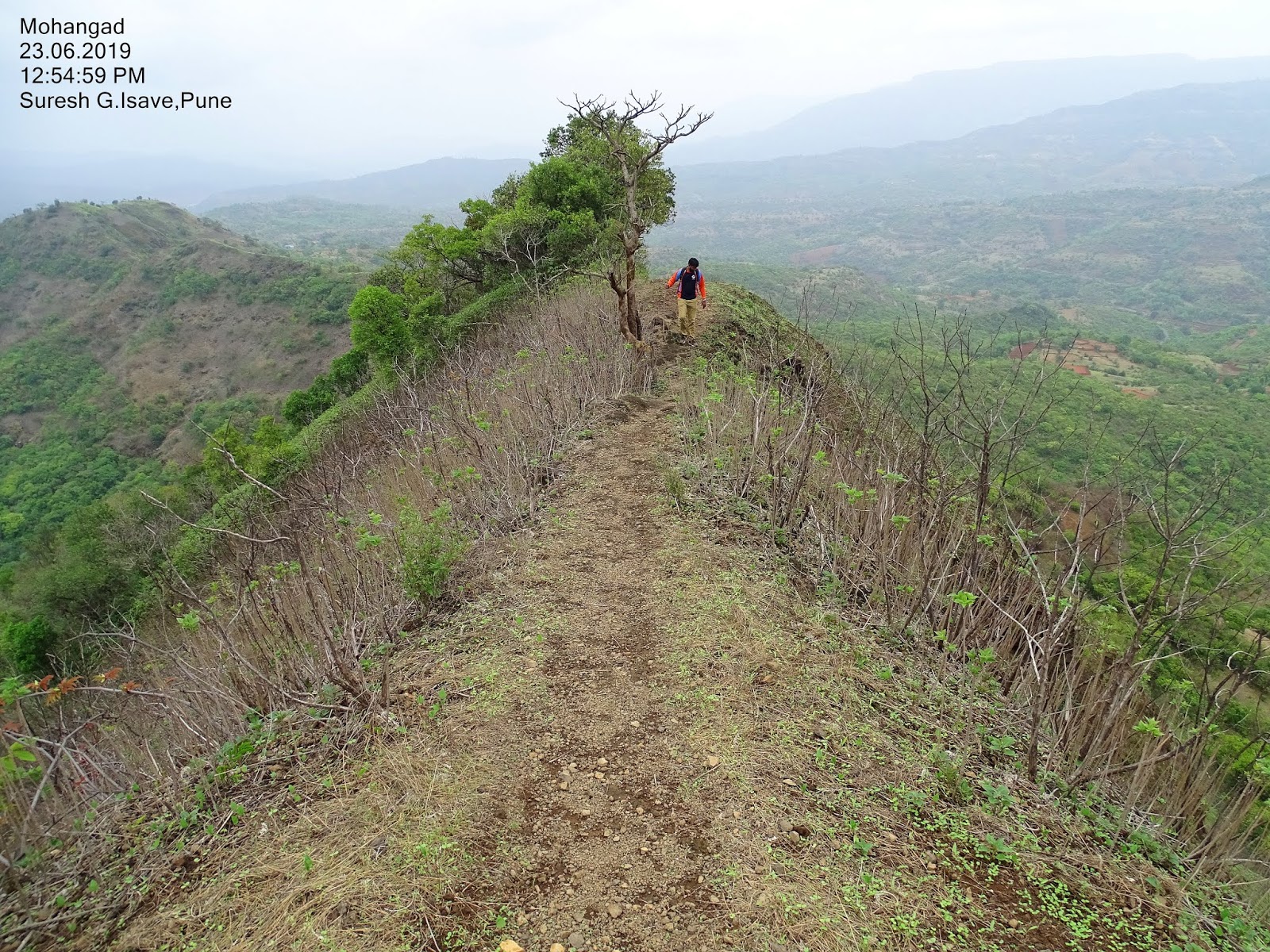
Need to follow proper trek route. There are many diverting routes. Keep watch on the fort and slope to select right route. Go right turn to ascend. Then go to narrow pass (Khind), then take left turn which going in ascending direction. Then there will three small plateau like spots and thick vegetation spots. After 70/80 minutes you will will be on the top and can see huge rock patch. You may confuse how to climb it to be on the top of fort. That's why guide is commanded on this route. Follow the right side route which is taking you in dense forest. Actually its going the other side of the fort where the entrance. Th e route is thrilling through forest and slope. Keep walking straight ahead for 20/30 minutes unless you reach open space which is other side of the fort. This is spot where the other trek route confluence. A small stones are kept here to construct a small temple. Then go the other side route for 5 minutes, the route start ascend with rocky, simple patches. Then follow the rock cut raw steps. Take great care on the steps. Smooth and slippery in rainy days. After 15/20 minutes you will be on the top when you see ' Durgamata" Temple. This is almost end of trek.
What to See - There is no fortification found on the fort. There is no water found. Durgamata Temple is the only monument on the top. There is small plateau behind the temple which is the highest point on the fort. You have great panoramic view of around area. You can have your food here. 20/30 minutes are enough to explore the top.
View from Top - Raireshwar fort, Rohida fort, Mangalgad, Kawlyagad, Raigad, Torna, Rajgad, Mahabaleshwar, Varandha ghat, Mahad, Neera Devghar Dam etc.
Safety -
- Don't go alone, its a lonely place. Go with experienced company.
- It is not a popular trek, so take guide from a village.
- carry sufficient water because no water available on trek route or on the fort.
- Few portion of the route are with dense vegetation, so return before dark.
- Some spots with risky slopes, take care in rainy season.
- Take correct turn from main road towards Durgadi village because there is guiding board