Kailasgad fort is one of the unknown fort in the Tamhini ghat. It is also known as 'Ghod Manjaricha Dongar' in Marathi.
I visited on 22.11.2020 with my Trekking Paltan Group Pune on bikes from Pune.
Shubham Mahajan, Madhav Bamne, Amol Gore, Suresh Isave (me) and Dnyaneshwar Arne @ Kundlika valley, on the way of Kailasgad
How to Reach : It is about 80 km from Pune to Vaduste village and 3 hours journey. The place is marked on Google, so no difficulty to find a place from anywhere.
Pune-Paud- Mulashi- Tamhnigoan - Hotel Kamat - Nive - take right turn for Lonavla & Bhambhurde road - Kundlika Valley & Andharban Trek start point - Pimpri Village - After about 5/6 km take right for Vaduste village ( Left road goes to Bhamburde-Ghangad-Lonavla)- Road is rough but still motorable. once you reach to Vaduste village still go little ahead for 1/2 km up to the trek start point to the small pass. See the parking place, I have marked in the Google map too.
If you coming from Mumbai you can come from Lonavla- Ambi Valley -Bhamburde- Vaduste.
Pune to Kailasgad
Parking : Parking is open and free. Just park off the road, so traffic not blocked. It is unsupervised parking.
Food and Stay : There are many options of food and stay at Pimpri Village before Vaduste. Pimpri is also known for Camping. But there is no Food and water on the the fort. Carry at least 3 liter water and food with you.
About the Trek : It is a moderate trek of 2 hours from base to Lord Shiva temple on the fort. 6 to 7 hours are sufficient for whole trek from ascending, exploring and descending. See the video below to understand the hike route. It is a 3D virtual tour with Google map. It will help you to plan your trek.
3D Tour of the trek route
Side view of the trek route
Front view of the trek route
Top view of the trek route.
Watch all the photos which are arranged in a sequence of a trek
The trek starts from this pass
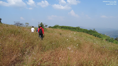
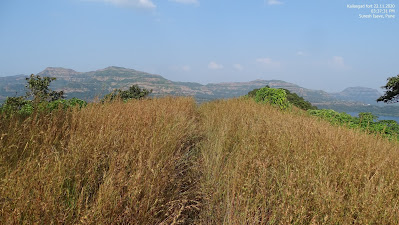
huge grass all around
after 20/30 mins walk Kailasgad fort appears
Go to the left side of the fort hill
Looking back
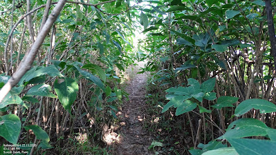
Rest in the shadow of 'Karawi' plants
after a 40 mins, plain trail ends and hike starts, then U turn to right side. See the spot in the trek images I shared above in the blog.
After the hike we reach on the fort where a vast plateau is seen.
We reach here. Left trail takes you to Kailas temple and right side is just a machi to view Mulashi dam view.
left side view
Mulashi Dam view
After watching a Mulashi dam backwater view come back the point where you reached first then go the left side as shown in the trek route images below.
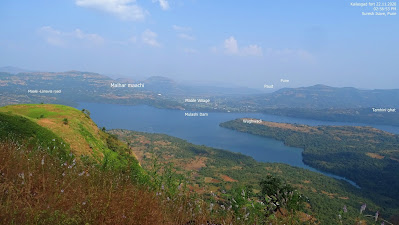
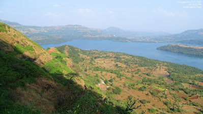
Amazing views of Sahyadri and Mulashi dam back water
full of grass and flowers
Mulashi Dam from Kailasgad
While going further you may not see any evidences of the fortification but still proceed further plain and straight.
This is the small temple of Lord Shiva (Kailas)
We can identify from distance because of the saffron Flag
After a trek of 2 hours and 30 minutes we reached here. Actually 1.5 to 2 hours are sufficient to reach here. We took lots of photo stops so we took that much time.
Panoramic view of the fort
View from the edge of the fort. No Fortification found.
Panoramic view from the fort
Trekking Paltan special - Lunch time
Mahadev Bamne, Amole Gore, Suresh Isave(me), Shubham Mahajan and Dyaneshwar Arne
Return Journey
Dung of rabbits
Reached base after about One hour
Tamhini Ghat
Hotel Sunset Point
Surprised on the road near Mulashi Dam
Our Itinerary : Date 22/11/2020
7:00 Pune Journey Started
8:30 - 9:15 Breakfast at Mulashi
10:00 - 10:30 - Photo stop at Kundalika Valley
11:30 - Reached at Base Vaduste Village
11:50 - Ascending started
2:00 - Reached on the top
2:00 - 3:45 - Lunch and Exploration
3:45 - 5:00 - Descending
5:00 - Reached at base (parking)
5:15 - Return Journey started
6;00- 6:20 Tea Break at Mulashi dam
8:20 - Reached Pune










How can I share a blog on my own trekking experience here ?
ReplyDeleteVery nice👍
ReplyDeleteSpecial thanks for the route map images . Very very helpful for me .
ReplyDeleteSpecial thanks for the route map images . Very helpful for me .
ReplyDeleteIn Lonavala, relax in the middle of nature with Pawna Campers. Everyone looking for outdoor enjoyment and tranquility should go!
ReplyDeletecamping in lonavala